|
|
Lake District Valley and Low-level WalksHarrop tarn and Ullswater (Dacre and Dalemain)Harrop Tarn - 2 milesBefore Manchester Corporation dammed Thirlmere, virtually destroying the hamlet of Wythburn, an important track left this settlement, going over the Armboth Fells to Watendlath and Borrowdale. The track is still there, though almost lost on the summits in mire. The fell has the reputation of being the wettest in the Lake District. Manchester chose well for its water supply. However the first part of this track, as. far as Harrop Tarn makes a very pleasant walk. Everyone can do it, though its steepness will slow down the less energetic. Some wetness cannot be avoided. There is a headless ghost at the tarn, it is said; a minor hazard you are hardly likely to meet in daylight. Thirlmere is reached by the A591 from
Keswick-the Windermere road, turning right at the end of the dual
carriageway to go along Thirlmere's western shore road. From the The main path from Wythburn can be seen going up the hollow. Follow the path you are on, however, as it zig-zags parallel with the beck you should hear on your right. One or two cairns mark the route, though they are rather unnecessary. The path follows a fence, and then the path crosses the fence by an eccentric stile and goes into the wood among pines and Norway spruce. The path reaches a beck which must be
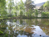
crossed to follow the path on the other side. Harrop Tarn appears on the
left. The path rises with a beck on the left, and then there is a
Y-junction. The right-hand way is a hard forest road. Take this. It leaves
the beck and is joined by another track from the left, shortly. Continue
on. Another track joins from the left and then a descent is begun. There
is an old alder swamp on the right. Helvellyn can again be seen over the
tree canopy ahead. In one of its gullies you can see an old mine, which
began well but proved to be unprofitable. Dacre and Dalemain - 5.5 milesThe geology of an area determines its landscape. The Lake District has much variety in landscape because of its extraordinary geology. The rocks of the Borrowdale volcanic series provide the dramatic craggy landscape; the ancient rocks which make up the Skiddaw slate series make up the smooth-lined bulk of the Northern fells, and of Black Combe in the south-west. Looking northwards from Hallin Fell there is a different form of landscape of gentler hills and fertile plains. This is the landscape of Old Red Sandstone and limestone. In it are the ancient seats of Dacre and Dalemain. To walk here is like being in a different country - border country with a turbulent history. The walk described goes by Dacre Castle, Dacre's ancient church, and by Dalemain Park. There are no hills to climb of any height, but some of the walk is by grass paths, and by the riverside, so waterproof footwear is desirable. The walk starts at the car park at the foot of Ullswater, at Pooley Bridge, on the west side of the bridge. The way is by the path which you can see on the west side of the car park along the edge of the wood. At the time of writing access to it is through the entrance to the car park and over a stile. Follow this broad path through the very mixed woodland. The path rises into oaks. When the path eventually comes close to a fence as it curves left round the wood, a stile will be seen over the fence. Cross this. Go forward and left towards a gate in the fence and hedge opposite. This leads onto another path alongside a fence going off to the right. Walk alongside this fence to a gate at its far end. Turn left through this gate and head for the gate opposite. You reach a road. Opposite, on the other side of the road, you will see two gates, one on either side of a sycamore tree. Go through the one on the right. Follow the fence. Go through gate and continue with fence. There are some old oaks at the end of this path before it reaches a gate. You join a macadam lane, turn right. Go on to a T junction and turn left. Walk along the grass verge, and you lose height towards the village of Dacre. The castle can be seen on the hillside opposite. Go over the arch bridge across the river (Dacre Beck). Looking over the bridge you will see that the river slides over a sandstone bed. The bridge itself is built of the same material. Continue on up the road, and on the side of the barn on the right you will see that it is built from a mixture of sandstone and limestone, and the roof is of sandstone. A road joins from the left but continue on into the pretty village, and take the turning on the right to the church. The church stands on the site of the Saxon monastery mentioned by the Venerable Bede in his history. All that remains of this are traces of foundations, and an old drain. The present structure dates from Norman times. The round piers are dated around 1250, the octagonals show some reconstruction around 1400. There are some stone fragments of interest (a leaflet giving information about the church is available). On the south side of the chancel is a stone traditionally said to represent the "Peace of Dacre" signed in the year 926 between Athalston of England and Constantine of Scotland. In the churchyard are four mysterious
stones of unknown origin. They probably came from the Castle. Going
anti-clockwise from the north west the first bear is asleep More walks: Part 2 page 14 Part 2 page 13 Page 2 page 2 Page 2 part 3 |
|
|
|
|


